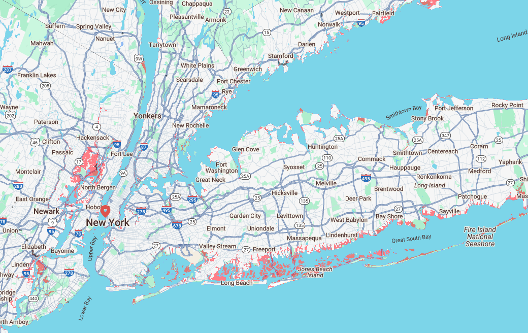
An interactive map shows which parts of New York are most vulnerable to sea-level rises and increased flooding due to climate change.
The map, developed by researchers at Climate Central, uses advanced predictive modeling to show which areas could be underwater by 2050. Areas that are at risk of being lower than the water level on the map are shaded in red.
Manhattan would be mostly safe, according to this projection, with only the smallest amount of water encroaching on the city’s outermost edges.
The Brooklyn Navy Yard, the historic industrial complex along the East River, would experience some water inundation.
The areas most at risk across the state of New York would be the land across the southern coast of Long Island and the barrier islands below it.
According to the map, many coastal neighborhoods in Suffolk and Nassau counties, including Freeport and Island Park, would be submerged.
The …


![One business worries about TikTok ban, cyber security expert says its good for now [Video]](https://aimarketingshowcase.com/wp-content/uploads/2025/01/mp_578288_0_MTTMBBZZAFA5PNUGRXKK3NHEFApng.jpg)
